The Mani Peninsula drops south from the Peloponnese like a clenched fist, its spine of limestone mountains falling sharply into deep water on both sides. This is the middle of the three peninsulas that form southern Greece, and it has spent most of its history refusing to be tamed by anyone — Ottomans, Franks, or modern developers alike.
What you find here is unlike the rest of Greece. No Cycladic whitewash, no cruise-ship crowds, no infinity pools overlooking caldera views. Instead, there are stone tower houses built for centuries of family warfare, fishing villages where the taverna still outnumbers the souvenir shop, and a coastline that alternates between lonely pebble coves and long stretches of sand where loggerhead turtles nest in summer.
| Region | Southern Peloponnese, Greece |
| Nearest airport | Kalamata (KLX) — direct European flights in summer |
| From Athens | Approximately 3 hours by car, 3 h 15 min by express bus |
| Car needed? | Yes — essential for exploring the peninsula |
| Best for | Road trips, history, hiking, photography, authentic Greece |
| Minimum stay | 3 full days; 5–7 days recommended |
| Best season | May–June and September–October |
The Mani rewards slow travel above all. It is a place for long coastal drives with the windows down, for sitting in a harbour taverna watching the light shift on the mountains, and for walking through silent villages where the only tall structures are the defensive towers that defined life here for centuries. If you are planning a Peloponnese itinerary that includes Monemvasia, the Mani is its natural companion — equally dramatic, equally steeped in history, and considerably less visited.
The Mani in Two Halves
The peninsula is traditionally divided into the Outer Mani (Exo Mani), the western coast facing the Messenian Gulf, which is greener, more accessible, and home to the popular villages of Kardamyli and Stoupa, and the Inner Mani (Mesa Mani), the harsher, drier eastern and southern portion centred on Areopoli, where the landscape becomes increasingly austere and the tower villages reach their most dramatic form. Most visitors explore both sides, looping from one coast to the other through the Deep Mani in between.
Why the Mani Stands Apart
The Mani’s identity comes from its geography. The Taygetos mountain range, which peaks at 2,407 metres at Profitis Ilias, forms a natural barrier between the peninsula and the rest of the Peloponnese. For centuries, this isolation meant that whoever lived here answered to nobody — not the Byzantine emperors, not the Ottoman sultans, and certainly not the tax collectors from Tripoli or Sparta.
The Maniots — the peninsula’s native inhabitants — were descendants of the ancient Spartans and the refugees who fled into the mountains during successive invasions. They organised themselves into powerful family clans, built fortified tower houses as both homes and strongholds, and engaged in vendettas that could last for generations. A family’s wealth and social standing were often measured by the height of its tower rather than the size of its land.
A 2026 study by the University of Oxford, published in Communications Biology, found that the Deep Maniots — those living at the very southern tip of the peninsula — form one of the most genetically distinctive populations in Europe, with many lineages traceable to the Bronze Age and Iron Age of Greece. The researchers noted that historical isolation, combined with the clan-based social structure, preserved genetic patterns that had been altered elsewhere in the Balkans after the fall of Rome. It is a scientific confirmation of what the landscape already suggests: this place has been doing things its own way for a very long time.
A History Written in Stone
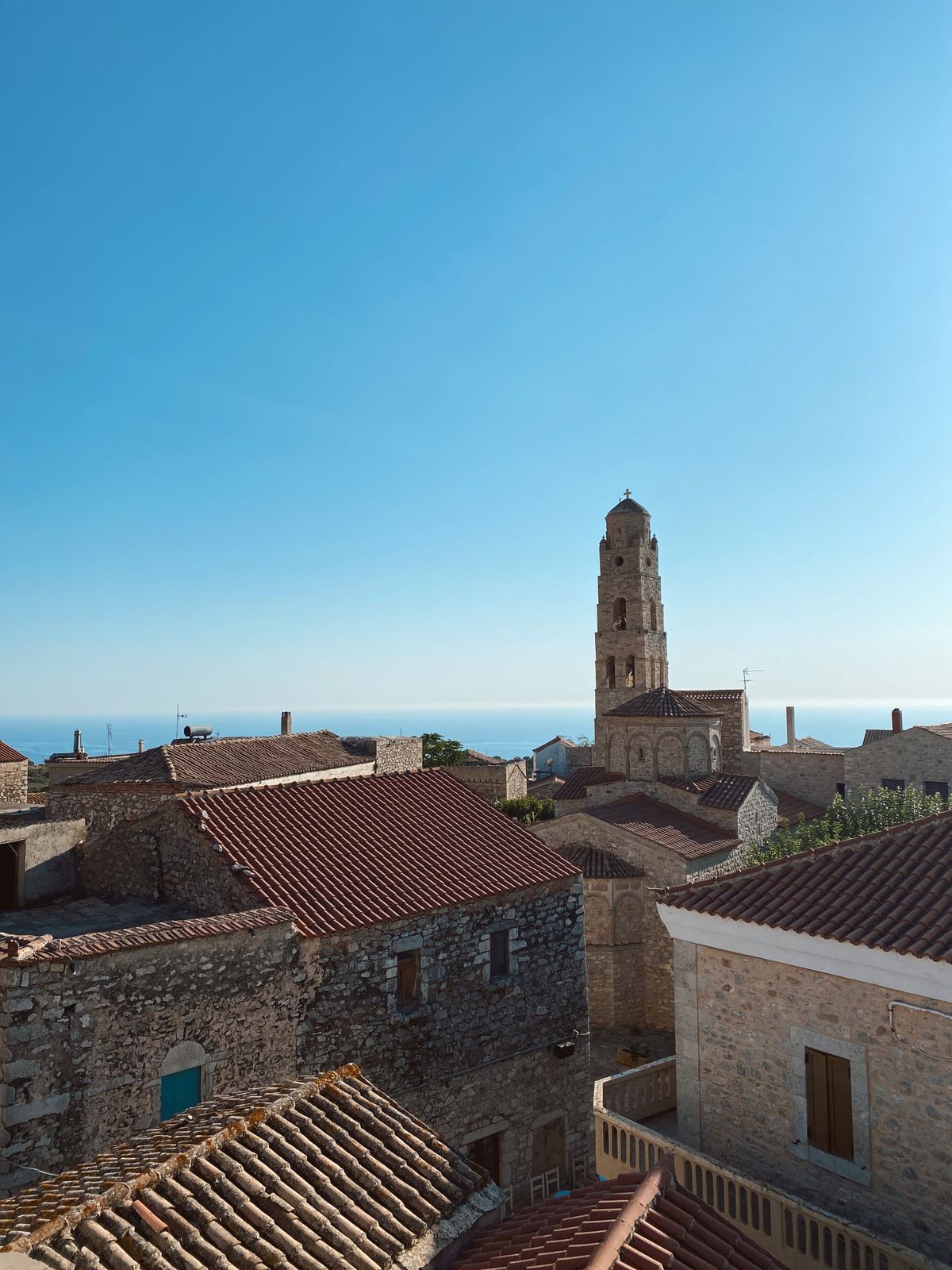
The Mani’s most visible expression of history is the tower house, or pyrghospita, which defines the peninsula’s skyline from Kardamyli in the north to Cape Tainaron at its southern tip. These towers were not decorative follies — they were functional fortresses, built by rival clans during the periods of intense vendetta warfare that dominated Maniot society from roughly the 17th to the 19th century.
During a vendetta, families would lock themselves inside their towers and attack the opposing clan from the upper floors. The aim was often nothing less than wiping out the rival family entirely. Neutral families in the same village would retreat to their own towers to avoid becoming collateral damage. The thick stone walls, small windows, and elevated entrances made the towers extremely difficult to breach — and the taller your tower, the greater your tactical advantage.
But the Mani’s most significant historical moment came on 17 March 1821, when Petrobey Mavromichalis — the last bey (ruler) of the Mani — raised the banner of revolt against Ottoman rule in Areopoli. This was eight days before the Greek War of Independence officially began elsewhere. Around 12,000 Maniots gathered in what is now Athanaton (Immortals’) Square under a white flag inscribed with the words “Victory or Death.” The Maniots’ reputation as fierce, independent fighters made them natural leaders of the uprising, and around 50 members of the Mavromichalis family alone gave their lives in the struggle for Greek independence.
The Outer Mani: Kardamyli and the Messenian Coast
If the Deep Mani is Greece at its most austere, the Outer Mani — the western coast facing the Messenian Gulf — is its gentler companion. The landscape here is softer, with olive groves running down to the coast and villages that feel less fortress and more Mediterranean.
Kardamyli is the natural starting point and the most comfortable base for exploring the western side. The British travel writer Patrick Leigh Fermor fell in love with this small coastal settlement in the 1950s, eventually building a home here with his wife Joan in the 1960s. They spent the rest of their lives in Kardamyli, and Fermor’s book Mani: Travels in the Southern Peloponnese remains one of the finest pieces of travel writing about Greece. The house, now owned by the Benaki Museum, operates as a residence for artists and scholars from June to September.
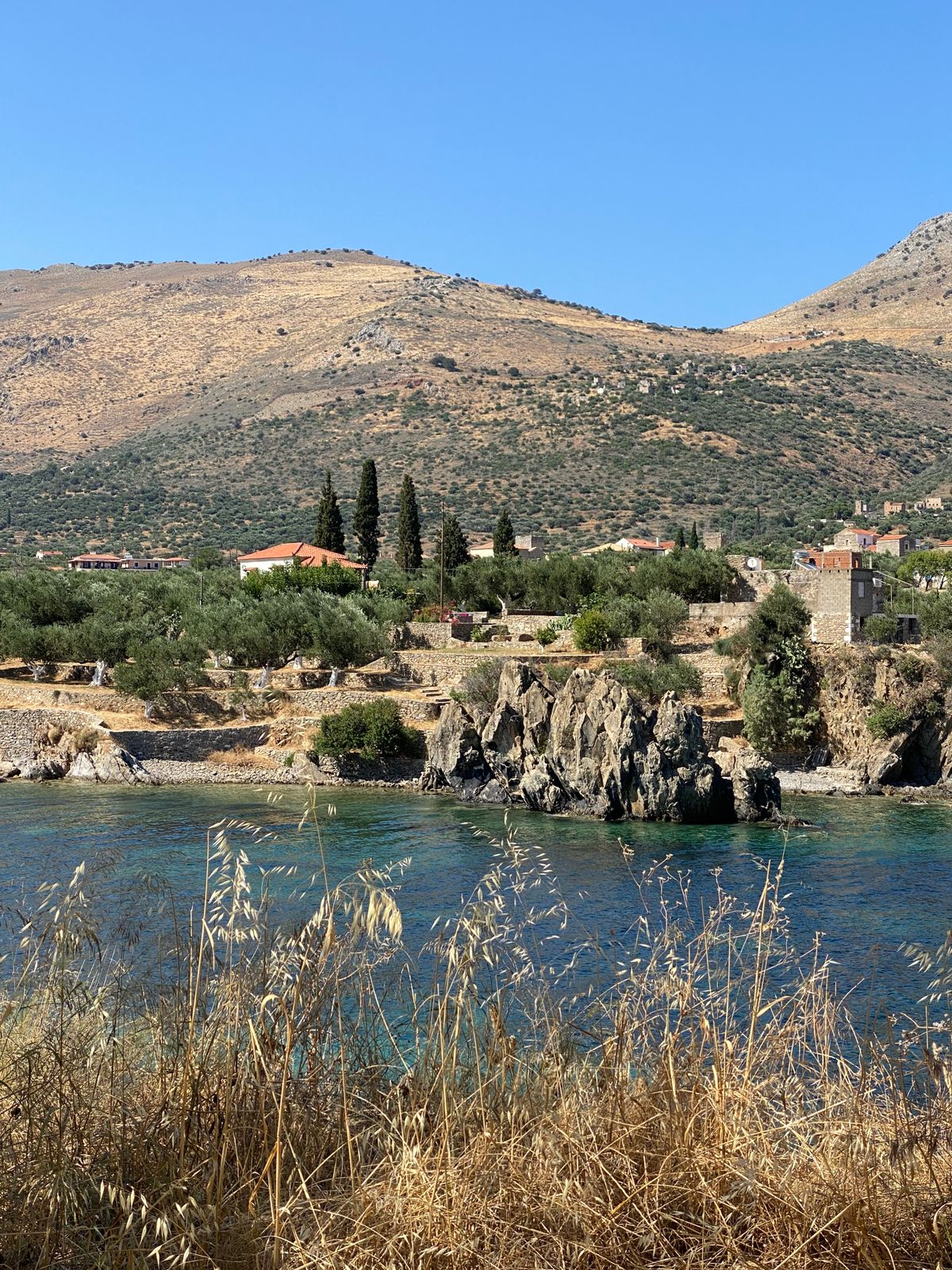
Kardamyli itself is modest — a main road, a pebble beach, a handful of waterfront tavernas, and the old fortified quarter with the Mourtzinos-Troupakis Tower and the church of Agios Spyridon. But it is the access to the surrounding landscape that justifies staying for several days. The Viros Gorge, which cuts deep into the Taygetos mountains behind the village, offers some of the finest hiking in the Peloponnese, with trails that follow parts of the ancient Royal Road that once connected Kardamyli to Sparta. The gorge passes through dense vegetation, past Byzantine chapels tucked into rock faces, and across dramatic limestone formations.
Stoupa, a few kilometres south, is the most developed settlement on this coast, with two sandy beaches — Stoupa Beach and Kalogria Beach — that are among the most family-friendly in the entire Mani. Underground freshwater springs feed into the sea here, keeping the water unusually cool and clear. For families with young children who want the convenience of organised beaches with sunbeds and nearby restaurants, Stoupa is the obvious choice — and if sandy, family-friendly beaches are your priority, you may also want to explore our guide to the best family-friendly Greek islands. It lacks the atmospheric weight of the Deep Mani, but it compensates with ease and comfort.
The Inner Mani: Areopoli and Beyond
South of Oitylo Bay, the landscape shifts noticeably. The olive trees thin out, exposed stone begins to dominate, and the villages grow quieter with each kilometre. This is the beginning of the Inner Mani, and Areopoli is its gateway.
Areopoli — literally “City of Ares,” the Greek god of war — is a town built from the same grey stone as the mountains around it. Its main square, Athanaton Square, is dominated by a bronze statue of Petrobey Mavromichalis, who launched the revolution from this very spot. The Taxiarches church, built by the Mavromichalis family in the second half of the 18th century, has the tallest bell tower in the Mani, its facade decorated with carved zodiac symbols that scholars interpret as a link between the ancient world and Christianity.
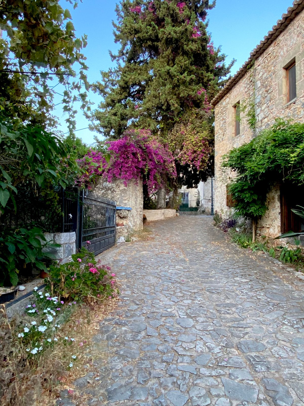
The town’s alleys reward unhurried exploration on foot — cobblestone paths wind between restored tower houses, small churches with medieval frescoes, and courtyards filled with bougainvillea. The Pikoulis Tower, a small museum in a renovated tower house, displays religious artefacts and engravings from across the peninsula, including a memorably odd 18th-century painting of John the Baptist holding his own severed head.
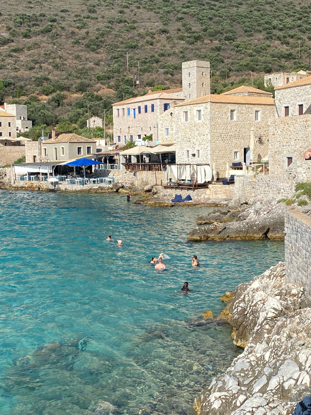
Limeni, just below Areopoli on the coast, may be the most photographed spot in the Mani. A cluster of stone tower houses rises directly from water so transparent it appears to have been digitally enhanced. The village was recognised as Place of the Year by a major Greek media outlet in 2025, which tells you something about how quickly word is spreading. The Mavromichalis family tower stands at its centre, a four-storey structure that once served as a gathering hall for regional chieftains. Today, a few waterfront tavernas serve grilled fish with tables practically in the sea — arrive early in summer to secure a spot.
Villages of the Deep Mani
South of Areopoli, the peninsula narrows and the landscape becomes progressively more barren. This is the Deep Mani, and it rewards those willing to drive slowly on its winding roads and stop often.
Vathia is the most dramatic of the Deep Mani villages — a cluster of 18th and 19th-century tower houses perched on a hillside overlooking the sea. From a distance, it resembles a medieval citadel, but it was never a single fortification. Each tower belonged to a different family, and the proximity was often the source of conflict rather than cooperation. The village was largely abandoned in the mid-20th century as residents left for Athens and larger towns. A few towers have been restored as guesthouses, but most remain empty and slowly crumbling. The best views of Vathia are from the road on the opposite side of the valley, where you can pull over and take in the full sweep of towers against the sky.
Gerolimenas, on the western coast of the Deep Mani, is a fishing village in the truest sense — a small harbour, a handful of stone buildings, and a quietness that borders on solitude. It was reportedly a pirate hideout in centuries past, which makes sense when you see how the bay is tucked away from open sea. It makes one of the best bases for exploring the southern peninsula, with a few small hotels and tavernas, though services are limited outside peak summer.
Cape Tainaron: Walking to the Edge of Greece
Cape Tainaron — also known as Cape Matapan — is the southernmost point of mainland Greece and the second southernmost point of mainland Europe. According to ancient Greek mythology, it was also one of the entrances to the Underworld, the realm of Hades. This is where Heracles is said to have dragged Cerberus out of the abyss, and where Orpheus descended to retrieve Eurydice.
Reaching the cape requires driving to the small fishing harbour of Porto Kagio, then walking approximately 45 minutes along a coastal path to the lighthouse at the peninsula’s tip. The walk is easy and mostly flat, suitable for families with children old enough to manage an hour of walking, though there is no shade and no drinking water along the route — bring both.
Near the start of the trail, the remains of an ancient temple dedicated to Poseidon sit on the hillside, with Roman-era mosaics visible under protective shelters near the parking area. The temple was converted into a Christian church during the Byzantine period, and services are still held there on occasion. The ancient city of Taenarum once stood here, known for its green marble and the Lacedaemonian Purple dye extracted from the murex snails that thrived in these coastal waters.
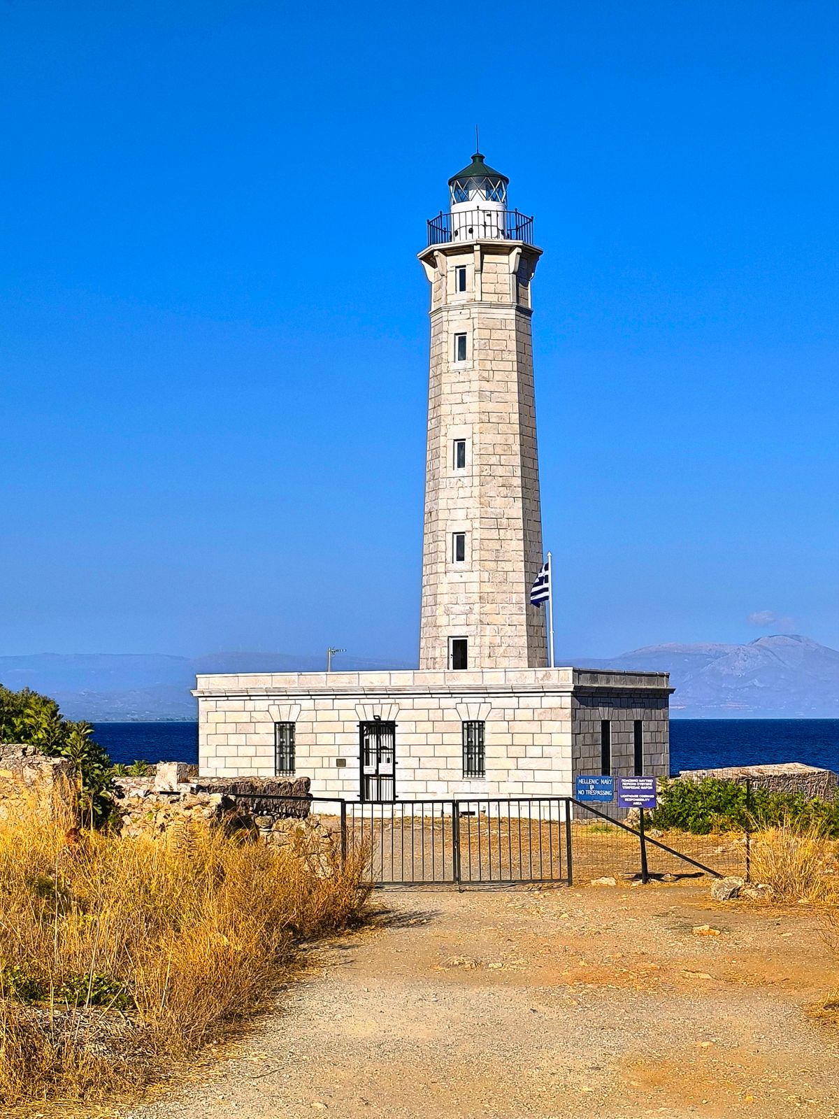
The lighthouse itself, built in the 19th century, marks the exact point where the two gulfs converge. On a clear day, the views stretch in every direction across empty sea. On a windy day — and it is often windy here — you will understand why the ancient Greeks placed the boundary between the living and the dead at this spot.
The Diros Caves
The Diros Caves (officially the Vlychada Cave), located approximately 6 kilometres south of Areopoli on the road to Gerolimenas, are one of the most remarkable natural sites in Greece. This partially submerged cave system has been explored to a depth of approximately 5,000 metres, though only about 1,200 metres are accessible to visitors — by small guided boat, followed by roughly 300 metres on foot.
The boat ride passes through chambers filled with stalactites and stalagmites formed over millions of years, with names assigned by speleologists that reflect the otherworldly atmosphere: the Velvet Stalactite, the Hallway of Dreams, the Lake of the Nymphs. The temperature inside stays at around 18 degrees Celsius regardless of the season, so bring a jacket even in the height of summer.
The caves’ human history is as remarkable as their geology. Archaeological research has shown they were inhabited during the Late and Final Neolithic Period, approximately 4800 to 3200 BC, with evidence of daily domestic life, burial practices, and what may have been ritual worship. The nearby Diros Caves Museum displays pottery, tools, jewellery, and figurines recovered during excavations. Admission is approximately 12 euros for adults — prices should be confirmed before visiting. The caves are open daily, generally from 08:30 to 17:30, though hours can vary by season. Queues can be long in summer, so arriving early or booking ahead is strongly recommended.
Beaches Worth Finding
The Mani’s coastline mixes long sandy stretches with secluded pebble coves, though it is worth knowing that conditions can change quickly with the wind direction, particularly on exposed beaches. Most beaches in the Deep Mani are unorganised, meaning no sunbeds or lifeguards outside peak season.
| Beach | Type | Best for | Access |
|---|---|---|---|
| Mavrovouni | Sand, 5 km long | Windsurfing, turtle watching | Easy, organised |
| Stoupa | Sand, shallow | Families, swimming | Easy, organised |
| Kalogria | Sand, very shallow | Young children, paddling | Easy, some facilities |
| Foneas | Pebble, turquoise | Snorkelling, scenery | Steep path down |
| Marmari | Sand, rare for Deep Mani | Families, afternoon sun | Easy from road |
| Porto Kagio | Pebble, sheltered | Swimming before Cape Tainaron walk | Easy, tavernas nearby |
Mavrovouni, just south of Gytheio, stretches for approximately 5 kilometres — it is mostly sandy, well-organised with sunbeds and beach bars, and doubles as a nesting site for loggerhead sea turtles (Caretta caretta) during the summer months. Windsurfing is popular here when conditions allow.
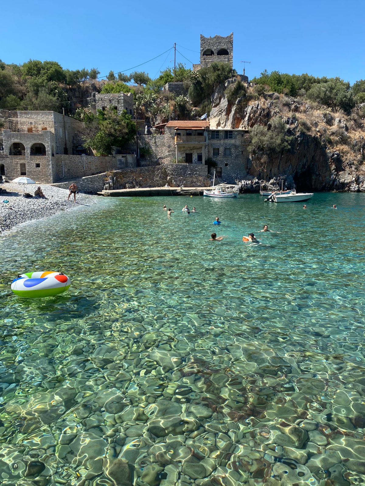
Foneas, close to Kardamyli, is a pebble beach backed by dramatic rock formations, with water that turns an unusual shade of blue-green. A large rock in the centre of the beach serves as a natural diving platform. Access is via a steep path that may be challenging for those with mobility difficulties.
Marmari, on the western side of the Deep Mani between Porto Kagio and Gerolimenas, offers something rare in this landscape: actual sand. The water stays shallow for an unusual distance from shore, making it one of the few genuinely family-friendly beach options in the Deep Mani. It catches the afternoon light beautifully and is usually quiet even in high season.
What to Eat in the Mani
Maniot cuisine is shaped by a landscape that offers more stone than soil: olive oil, cured pork, wild herbs, and honey form the foundation of nearly everything on the table.
The signature product is syglino — pork that has been salted, then smoked for hours over aromatic wood, traditionally sage, cedar, or mastic. After smoking, the meat is simmered with wine and orange peel, then preserved in olive oil or rendered pork fat. The result is intensely flavoured, somewhere between Italian prosciutto and pancetta, and it appears across the Maniot menu — sliced as a meze with local wine, folded into omelettes (a preparation called kagianas), or mixed through pasta with cream. If you eat one thing in the Mani that you cannot easily find elsewhere in Greece, make it syglino.
Lalangia (sometimes spelled lalaggia) are fried dough strips, served hot with honey or dusted with sugar, commonly eaten at festivals and as a morning snack. Pitarakia are small pies filled with seasonal greens or local cheese, varying from village to village in shape and filling. The olive oil here is typically robust and peppery, pressed from trees that in some cases are several centuries old, and local thyme honey from the peninsula’s scrubby hillsides is excellent — look for it at roadside stalls and village shops.
The waterfront tavernas in Limeni and Gerolimenas tend to focus on fresh fish and seafood, while inland villages lean toward grilled pork, rustic pies, and slow-cooked dishes that make use of the area’s own olive oil and herbs. Look for anything that includes local pork, seasonal greens gathered from the hills, or the area’s own cheese.
How to Get There and Get Around
Kalamata is the gateway to the Mani. Its airport receives direct flights from several European countries during summer, including the UK, France, Germany, and Italy. There are currently no direct flights between Kalamata and Athens.
From Athens, the fastest route is to drive — the toll motorway covers the distance in approximately 3 hours, with around 15 euros in tolls. The KTEL Messinias express bus from Athens Kifissos station takes approximately 3 hours 15 minutes and costs around 22 euros one way. From Kalamata, the scenic coastal road reaches Areopoli in about 1 hour 30 minutes, passing through Kardamyli and Stoupa along the way.
| Route | Duration | Notes |
|---|---|---|
| Athens to Kalamata (car) | ~3 hours | Toll motorway, approx. €15 tolls |
| Athens to Kalamata (bus) | ~3 h 15 min | KTEL express, approx. €22 one way |
| Kalamata to Areopoli | ~1 h 30 min | Scenic coastal road via Kardamyli |
| Kalamata to Gytheio | ~1 h 30 min | Via inland or coastal route |
| Gytheio to Areopoli | ~30 min | Good road via Oitylo |
A car is essential for the Mani. Bus services exist but are infrequent, and — importantly — the buses serving the Messenian (western) side do not connect with those on the Laconian (eastern) side. Many of the peninsula’s most rewarding villages and beaches are accessible only by car. Hire one in Kalamata, either at the airport or in the town centre.
Roads are generally good on the main routes between Kalamata, Areopoli, and Gytheio. South of Areopoli into the Deep Mani, roads become narrower and more winding, with occasional tight bends that require patience. There are, however, plenty of places to pull over for photographs, and traffic is rarely an issue outside July and August.
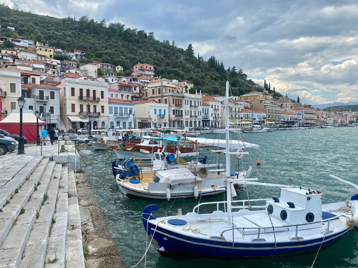
Gytheio, on the eastern coast, is the second main entry point to the Mani and the peninsula’s largest town. It was the ancient seaport of Sparta and today retains a pleasingly old-fashioned waterfront lined with neo-classical buildings and fish tavernas. A causeway connects it to the small island of Cranae (also called Marathonisi), where, according to mythology, Paris and Helen of Troy spent their first night after fleeing Sparta. The Tzannetakis Tower on the island houses a small museum of Maniot history. Gytheio is approximately 40 kilometres from Sparta and makes a good base for the eastern side of the peninsula, as well as for day trips to Monemvasia, which is roughly one hour to the east.
When to Visit and How Long to Stay
The Mani has a longer season than most Greek destinations, thanks to its southern position and the range of attractions that do not depend on warm water. Swimming is comfortable from late May well into October, and the peninsula’s cultural and walking attractions work even in winter, when the tower villages take on a brooding atmosphere under grey skies.
May to June is arguably the best period — temperatures are warm without being oppressive, wildflowers cover the hillsides, and the summer crowds have not yet arrived. September and October offer warm sea temperatures, quieter roads, and the softer light that photographers appreciate. July and August bring peak heat and domestic Greek tourists, particularly to the Outer Mani around Stoupa and Kardamyli. The Deep Mani remains relatively quiet even in high season, simply because fewer people venture that far south.
Three full days is the minimum needed to see the highlights without rushing — enough for one coast, the Diros Caves, and a couple of key villages. Five to seven days allows a thorough exploration of both coasts, the Deep Mani villages, Cape Tainaron, the caves, several beaches, and the kind of unhurried meals and afternoon swims that make this part of Greece so rewarding. Travellers on a broader Peloponnese or mainland Greece itinerary should allocate at least three nights to do the peninsula justice.
Who the Mani Is For — and Who It Isn’t
The Mani suits travellers who enjoy driving, who prefer authentic atmosphere over resort convenience, and who find abandoned tower villages more interesting than shopping districts. It is excellent for couples, history enthusiasts, hikers, and photographers. Families with older children who enjoy the outdoors will find plenty here, though families with toddlers may find the limited beach facilities and steep village paths more difficult to manage.
It is less suitable for travellers who want organised nightlife, resort-style beaches with activities, or who prefer not to drive. Public transport is minimal, and the peninsula’s appeal lies in its remoteness — which also means limited services, particularly in the Deep Mani outside peak season. If you need Wi-Fi and a cocktail bar within walking distance at all times, the Mani may test your patience.
The Mani combines naturally with nearby destinations. Monemvasia is approximately one hour east of Gytheio, and Mystras — the former Byzantine capital — sits roughly 40 kilometres north of Gytheio, on the road toward Sparta, and Nafplio is roughly two hours north if you are continuing through the Peloponnese. All three make excellent day trips or logical next stops. If Crete is on your itinerary, our Chania travel guide covers the western end of the island in detail. Travellers arriving from or continuing toward Crete can use the seasonal Seajets ferry that connects Piraeus to Gytheio, though schedules should be confirmed directly with the operator before planning around them.
This article was researched and verified as of July 2026. Travel information, including transport schedules, admission prices, and opening hours, may change. We recommend confirming time-sensitive details directly with official providers before travelling. While every effort has been made to ensure accuracy, Vivid Greece cannot accept responsibility for changes that occur after publication.