Drive an hour north-east of Athens and you cross a bridge so narrow that ships still wait for it to swing open, into a strait where the sea itself seems to forget which way it’s supposed to flow. On the other side is Evia, Greece’s second-largest island after Crete, a place with mountain refuges, dragon-shaped Bronze Age ruins, and a spa town that once treated Roman generals. Most people driving north on the E75 motorway never notice it’s there.
That’s the strange thing about Evia. It isn’t hidden by distance — Chalkida, its capital, is closer to central Athens than the airport is. It’s hidden by familiarity. Greeks have been going there for generations, which means it never needed a marketing campaign, which means most foreign visitors have simply never heard of it. Evia belongs to the Central Greece region, administratively grouped with Delphi and Thermopylae rather than with the Aegean islands, and that bureaucratic detail has quietly kept it off the well-worn island-hopping trail.
An island the length of a small country, connected to the mainland by a bridge where the current changes direction fourteen times a day — and somehow still a secret.
Where Evia Actually Is (and Why the Map Confuses People)
Evia, also spelled Euboea, stretches 180 kilometres from northwest to southeast, hugging the coast of the Greek mainland so closely that in places barely six kilometres of water separates the two. At its widest it reaches 50 kilometres across; at its narrowest, near Chalkida, the gap collapses to less than 40 metres. It is the sixth-largest island in the Mediterranean, and it belongs to the administrative region of Central Greece (Sterea Ellada), the same region that governs Delphi and the Fokida countryside on the mainland, together with Boeotia, Evrytania and Phthiotis.
That’s worth spelling out because it trips people up constantly: Evia is not part of the Cyclades, the Sporades, or any of the island groups you’d expect from an Aegean map. It’s a regional unit in its own right within Central Greece, run from Chalkida, and its cultural rhythm — mountain tavernas serving grilled meat, inland wine estates, a slower and more domestic kind of tourism — reflects that mainland connection more than it does the whitewashed-Cycladic image most people carry around in their heads before visiting a Greek island.
The island’s spine is a mountain range, an extension of the same geological chain that continues south into Andros, Tinos and Mykonos, which explains why Evia feels alpine in its centre and arid and Cycladic-looking in its south. Locals divide it informally into three: North Evia, green, forested and thermal; Central Evia, mountainous and wine-producing; and South Evia, dry, windswept and studded with mysterious ancient stonework. Each third has a completely different personality, which is part of why a single visit rarely does the island justice.
How to Get to Evia: Bridges, Ferries and a Very Strange Current
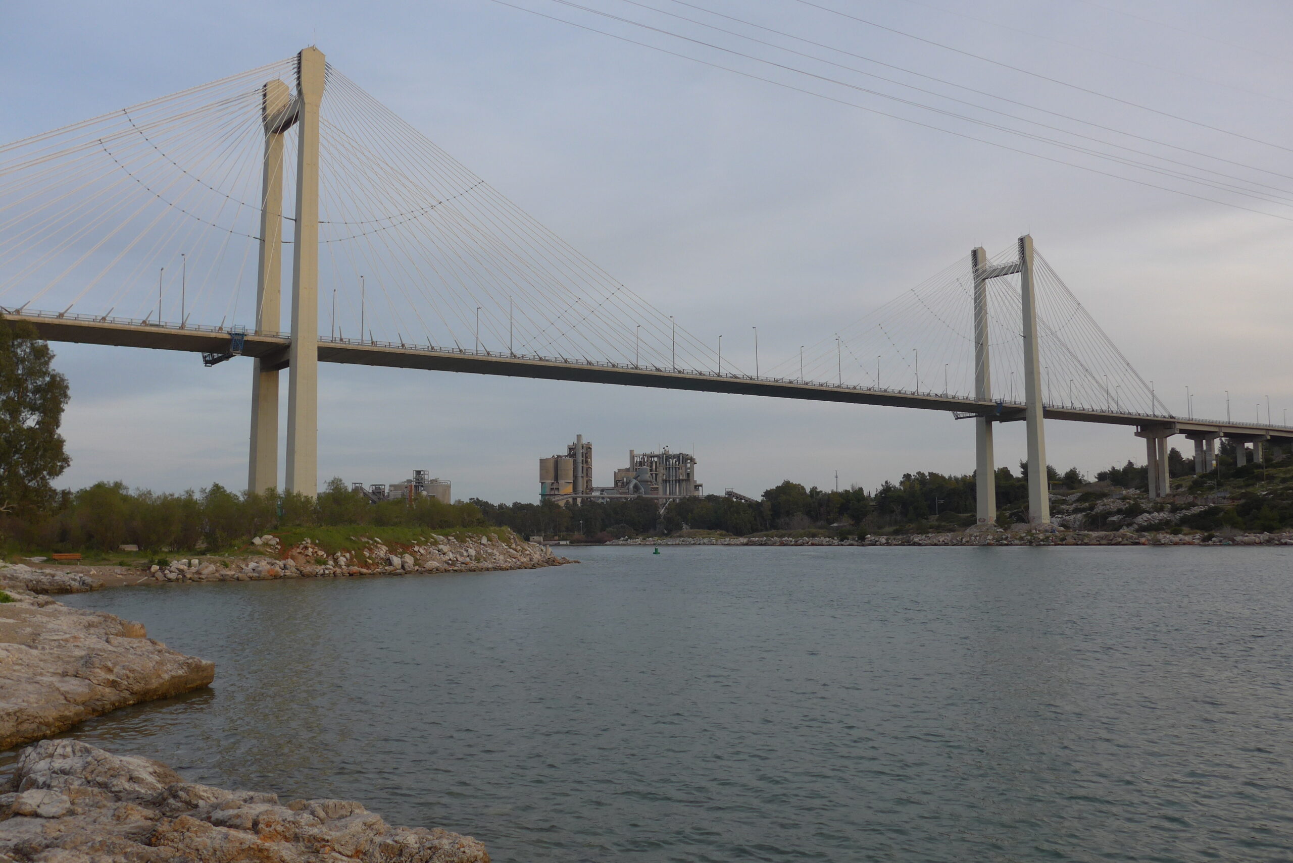
Unlike almost every other Greek island of any size, Evia doesn’t require you to set foot on a ferry at all. Chalkida is linked to the mainland by two bridges: a modern cable-stayed bridge built in 1992 south of the town, and the much older sliding bridge right in the historic centre, which opens periodically to let boats through the Euripus Strait. Driving from central Athens to Chalkida takes around an hour on the E75 motorway, and from there the whole island opens up by car.
If you’re headed straight for the south of the island, though, driving via Chalkida is not the efficient option — the internal road down the island’s length takes hours. A better route to Karystos and the southern beaches is the car ferry from Rafina, about 30 minutes east of Athens, across to Marmari, a crossing of roughly an hour with frequent daily departures in summer. For the northern thermal springs, a separate short ferry runs from Arkitsa on the mainland to Loutra Edipsou. And Eretria, in the island’s centre, has its own quick 25-minute hop from the mainland port of Oropos. There’s also a slow but scenic suburban rail connection from Athens to Chalkida for anyone travelling without a car.
| Route | Best for | Approx. journey time |
|---|---|---|
| Athens → Chalkida (E75 motorway, bridge) | Central and North Evia, no ferry needed | About 1 hour |
| Rafina → Marmari (car ferry) | South Evia, Karystos, Dragon Houses | About 1 hour by sea, plus 30 min to Rafina |
| Oropos → Eretria (car ferry) | Central Evia, archaeological sites, wine country | About 25 minutes by sea |
| Arkitsa → Loutra Edipsou (car ferry) | North Evia thermal springs | About 45 minutes by sea |
| Kymi → Skyros (passenger/car ferry) | Continuing on to the Sporades | Under 2 hours |
Chalkida and the Sea That Can’t Make Up Its Mind
Start in Chalkida, if only because you’ll probably pass through it anyway. The city itself is unglamorous and modern in most places, but its old bridge over the Euripus Strait is one of the strangest natural phenomena in Greece and worth building an afternoon around. The strait narrows here to under 40 metres, and the current through it reverses direction repeatedly, sometimes four times a day in a rough approximation of a tide, sometimes as often as fourteen times in 24 hours during certain lunar phases, with no clean predictable pattern at all.
People have been trying to explain this since antiquity. Aristotle wrote about it in his Meteorology. A persistent, almost certainly apocryphal legend claims he was so frustrated by his failure to fully explain the Euripus that he threw himself into it in despair — a story historians treat as folklore rather than fact, but one that every local guide will tell you anyway. It wasn’t until 1929 that the Greek astronomer Demetrios Eginitis published a full account, showing that the erratic reversals come from an interaction between the region’s weak Mediterranean tides and the narrow bottleneck of the strait itself, which amplifies otherwise minor water-level differences into currents of six to twelve knots. Stand on the old bridge at the moment of reversal and you can watch small whirlpools form as the water changes its mind.
North Evia: Thermal Springs, Green Hills and a Landscape Still Healing
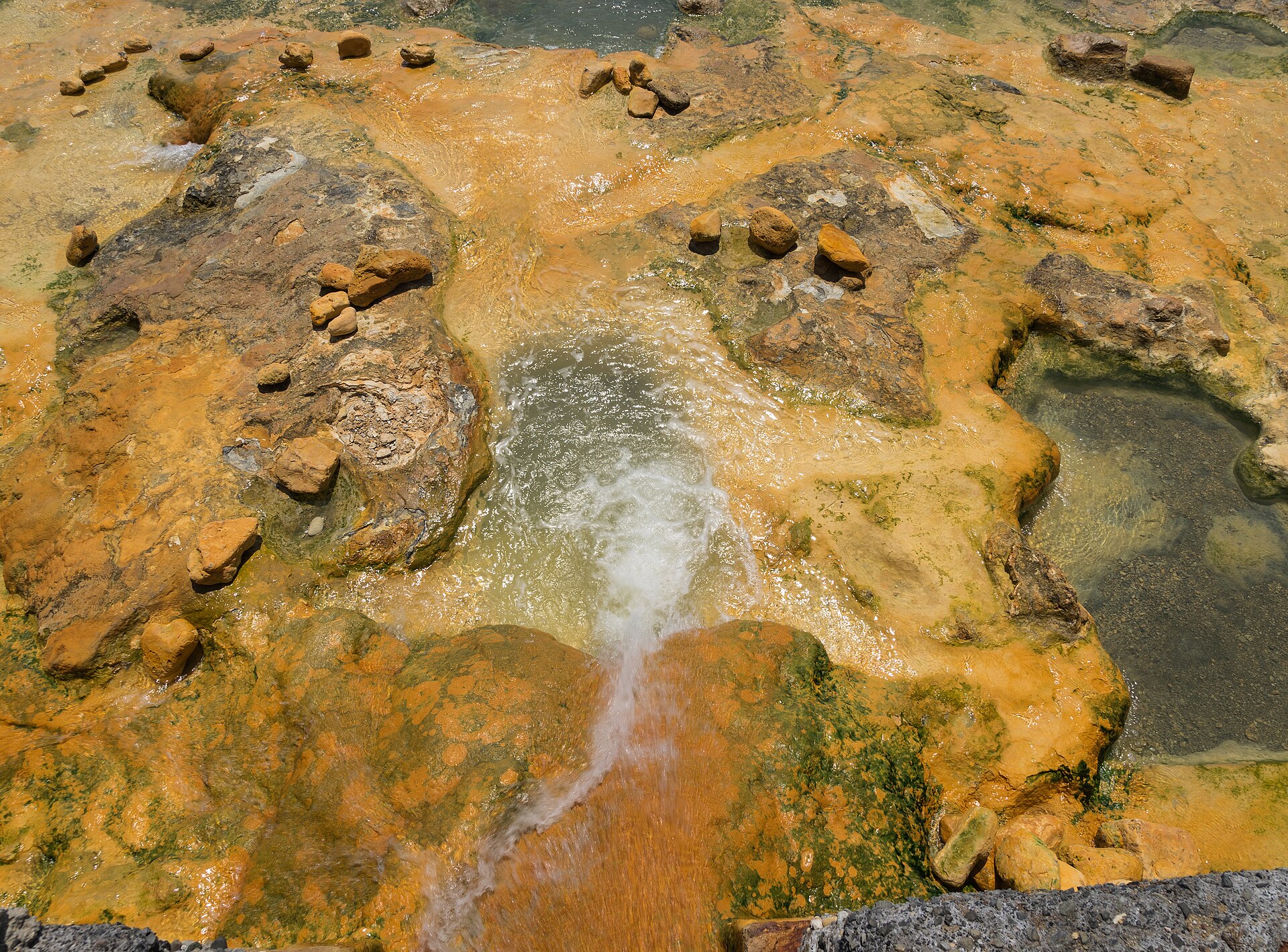
North Evia is the greenest and, historically, the most fashionable part of the island, built almost entirely around one resource: hot water. Loutra Edipsou has been a spa destination since at least the 4th century BC, when Aristotle, Strabo and Plutarch all wrote admiringly about its mineral springs. According to legend, Athena asked Hephaestus to strike the earth here so that Heracles could recover from his labours in the resulting warm water — a myth that, whether or not you believe it, tells you how long people have been coming here specifically to soak.
The Roman general Sulla was reportedly so taken with the springs that he ordered his soldiers to leave the area untouched, and the town’s most famous hotel, Thermae Sylla, still carries his name. In the 20th century the guest list read like a gossip column: Winston Churchill, Greta Garbo, Maria Callas and Aristotle Onassis all came through. More than sixty individual springs bubble up around the town at temperatures ranging from a gentle 34°C to a genuinely scalding 71°C, some emerging directly into the sea so you can find your own natural mixing point between hot mineral water and cool Aegean brine.
It would be dishonest to write about North Evia’s forests without mentioning the wildfires. In August 2021, one of the most severe fires in Greece’s modern history tore through more than 2,000 square kilometres of the region, devastating the pine forests around Rovies, Limni and Istiaia and destroying a significant share of the area’s historic olive groves — Rovies alone lost an estimated 30 to 40 percent of its main olive grove. Recovery has been slow but real: replanting programmes, sustainable-tourism initiatives and a renewed focus on the coast and food experiences that the fire didn’t touch have helped the area rebuild, though visitors driving through will still see burnt hillsides alongside the regrowth. It’s a reminder, if one were needed, that this corner of Greece is a living landscape rather than a postcard.
Limni, on the northwestern coast, escaped the worst of the damage and remains one of the prettiest towns on the island — a huddle of red-tiled houses on a green hillside, built on the site of the ancient town of Elymnion, whose residents retreated inland for centuries to escape pirate raids before returning to the coast in the 17th century and building the seafaring town you see today. Its promenade, lined with tavernas, is a genuinely lovely spot for an evening drink, and Rovies, nine kilometres further along the coast, makes a good base for exploring the olive groves and quieter beaches beyond.
Central Evia: Mountains, Wine and Ancient Mosaics
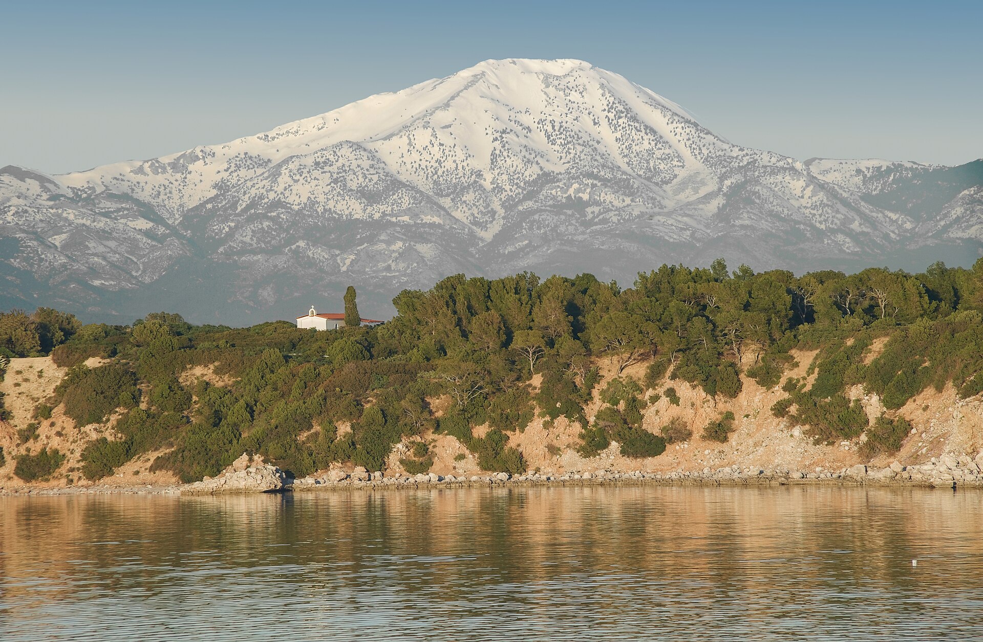
The island’s spine rises to its highest point at Mount Dirfys, 1,743 metres, a peak so prominent it’s visible for a hundred miles around and, on the ascent, feels far more like the Pindus range than anything you’d associate with a Greek island. The usual base is Steni, a mountain village of plane trees and running streams at Dirfys’s foot, which has built its reputation as much on meat-heavy tavernas as on hiking. The climb to the summit from the mountain refuge takes several hours over increasingly rocky, exposed terrain — not a beginner’s walk, but not a technical one either, provided you start early in summer to beat the heat and check conditions carefully in winter, when snow and fog are common. According to local myth, Dirfys is named for a nymph, daughter of Oceanus, who is said to live on its slopes — the kind of detail a good mountain guide works into the ascent to make five hours of climbing feel shorter.
Below the mountain, the Lilantine Plain has quietly become one of Greece’s more interesting under-the-radar wine regions. Wineries including Avantis Estate and Vriniotis grow both international grapes and rarer indigenous varieties like Mavrokoudoura, a dark-skinned relative of Mandilaria found almost nowhere else. Homer mentioned the Avantes, the ancient tribe of this plain, fighting at Troy in forty black ships — a detail Avantis Estate borrowed for its name. It’s a low-key wine-tasting scene, more likely to involve a chat with the winemaker than a polished tasting room, but that’s precisely its appeal.
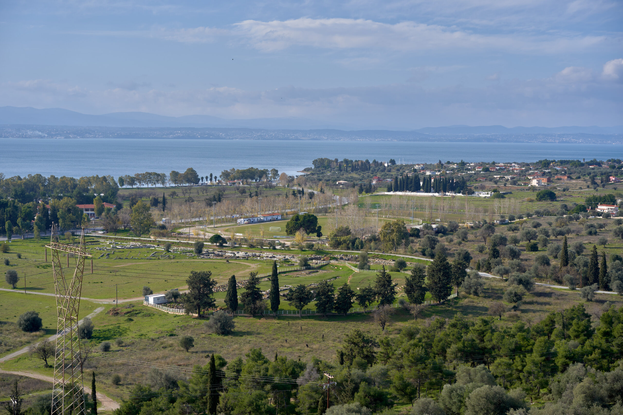
Central Evia’s other major draw is Eretria, a 20-minute drive from Chalkida, which was one of the most powerful city-states in ancient Greece and is now essentially an open-air archaeological site with a modern town built into its edges. Its 5th-century BC theatre is still visible on the slope above the harbour, and the House of Mosaics — a private residence built around 370 BC — preserves extraordinarily detailed pebble-mosaic floors depicting Nereids riding seahorses and battles between Arimaspians and griffins. The small Archaeological Museum of Eretria, run in collaboration with the Swiss School of Archaeology, ties the site together and is worth the entry fee alone for the mosaics moved there for protection.
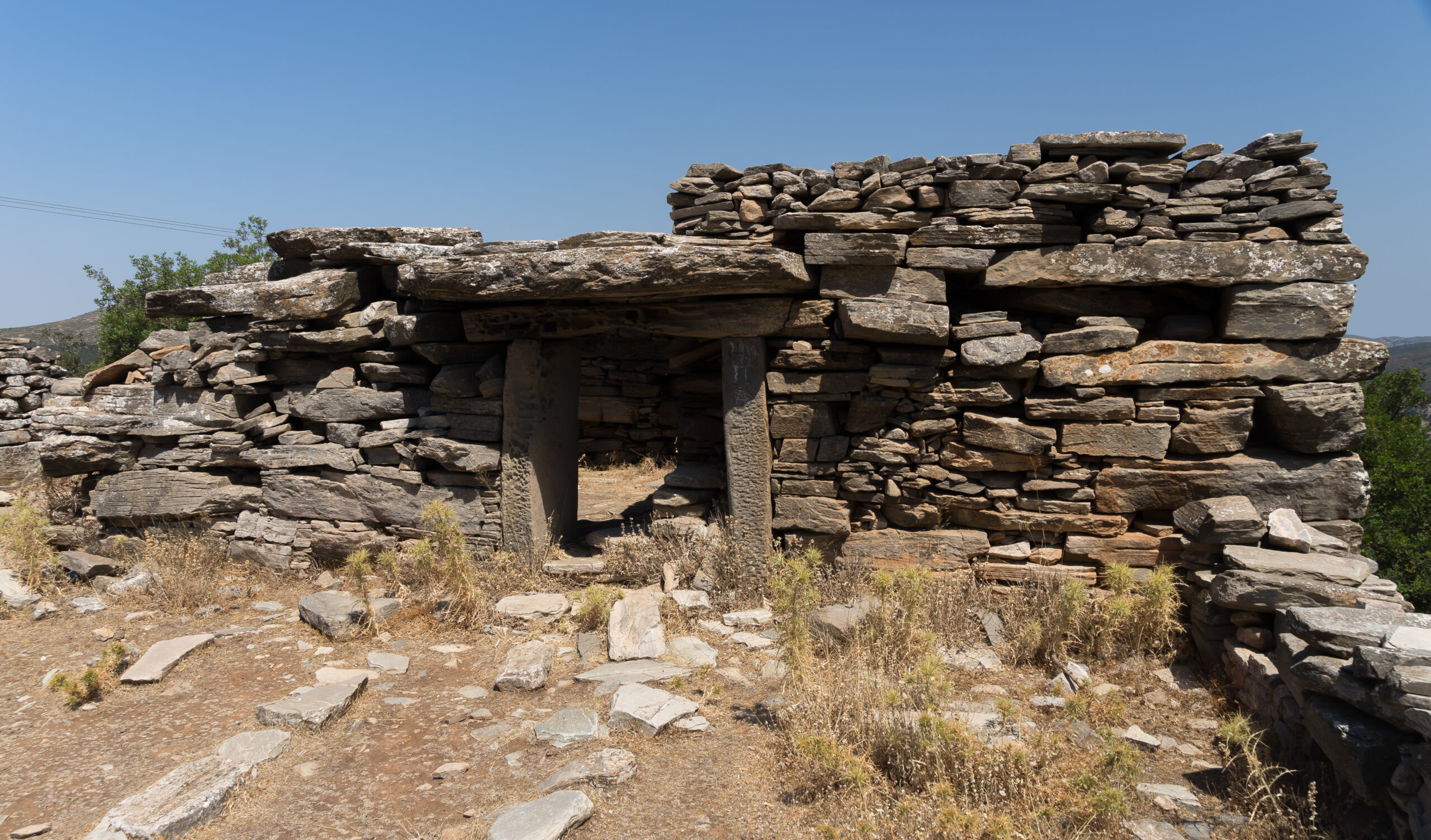
Twenty-five stone houses, built without mortar, on a mountaintop above the sea — and after two centuries of study, nobody can say for certain who built them or why.
South Evia: Dragon Houses, a Venetian Castle and the Island’s Best Beaches
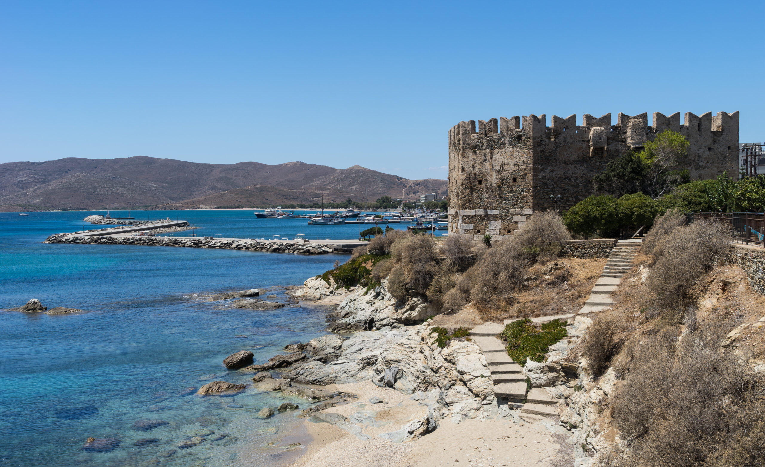
South Evia is drier, rockier and windier than the rest of the island, its landscape continuing the same geological line that surfaces again in Andros and the Cyclades. Karystos, the region’s low-key capital, sits below Mount Ochi with a Venetian sea fortress — the Bourtzi — guarding its harbour and a hilltop castle, the Castello Rosso, a 30-minute climb above town that rewards you with sunset views over the bay. The town itself has a relaxed, unhurried feel, popular with Greek weekenders but rarely crowded with foreign tourists, and its seafood and handmade pasta are reason enough to linger over a long lunch.
The real curiosity of the south, though, is the Drakospita — the Dragon Houses — a scattering of around twenty-five megalithic stone buildings on Mount Ochi and around the village of Styra, built from massive limestone blocks stacked without any mortar, with heavy slab roofs that have survived roughly 2,500 years of exposure. Archaeologists broadly date them to the Classical or early Hellenistic period, the 5th or 4th century BC, but there’s no ancient text that mentions them, no inscription that names a builder, and no settled theory about their purpose. Rural sanctuaries dedicated to Zeus and Hera is one leading theory, supported by animal bones and possible sacrificial remains found nearby and by an ancient association between Mount Ochi and the mythical “sacred marriage” of the two gods; farmhouses and shepherd shelters is the more prosaic alternative. Reaching the best-preserved example, on the summit of Mount Ochi above Karystos, involves a proper hike on dirt tracks past a chestnut forest, but the sense of walking up to an unsolved 2,500-year-old mystery is hard to replicate anywhere else in Greece.
From Karystos, the Dimosari Gorge cuts north to south through the mountains, a full-day trekking route for anyone with proper boots and a good half-day to spare, ending near sandy coastline rather than the alpine terrain you started in. The contrast — chestnut forest and running water giving way abruptly to Aegean scrub and sea — is one of the more dramatic transitions you’ll walk through on any Greek island.
The Best Evia Beaches, Region by Region
Evia’s beaches don’t get the international press that Milos or Zakynthos do, but there are dozens of them, and the variety across the island’s three regions means you can find almost any kind of coastline you’re after.
In the north, Chiliadou stands out for its combination of pebbles, fine sand and a small sea cave, framed by unusually lush vegetation for this part of Greece; it takes around an hour to reach from Chalkida along a mountain road, and its taverna-lined shore gets busy with Greek families in August. Further west, Gregolimano and the Lichadonisia islets — accessible only by boat — offer a much quieter, more isolated alternative. In the centre, Eretria’s town beach and nearby Amarynthos are easy, convenient options if you’re based around the archaeological sites, without being anyone’s idea of Evia’s best swimming.
The south is where the sand really improves. Agia Paraskevi, just outside Karystos, is a long stretch of fine sand and calm, shallow water, warmer than the beaches further north thanks to its more sheltered position and southern exposure. Psili Ammos, right in Karystos town, is another reliably calm option even when the north wind picks up elsewhere on the island. For something harder to reach, Archampoli, east of Karystos, involves a rough drive followed by a hike — or, in season, a boat from Karystos harbour — for a cove that rewards the effort with genuine solitude.
Kymi: The Balcony of the Aegean, and the Gateway to the Sporades
On Evia’s eastern coast, roughly across the island from Chalkida, Kymi has earned its nickname — “the balcony of the Aegean” — honestly. The town is built amphitheatrically up a green hillside, its neoclassical mansions and red-tiled roofs staring straight out over open water, with none of the shelter that keeps most Greek harbour towns tucked into a bay. It’s a functioning port as much as a pretty town: ferries from Kymi run to Skyros in well under two hours, making this one of the more painless ways to combine an Evia trip with a few days in the Sporades, and seasonal connections extend on to Skopelos and Alonissos for anyone building a longer island-hopping route. If you’re continuing that way, our guide to Skopelos beyond Mamma Mia is worth reading before you book the onward ferry.
Kymi’s Folklore Museum, housed in a three-storey neoclassical mansion, is a genuinely good rainy-day stop, and the walk up to the ruined Castle of Agios Georgios above town gives you the same “balcony” view that gave Kymi its name, minus the ferry traffic below.
When to Visit Evia
July and August bring the warmest sea temperatures and the busiest beaches, particularly around Karystos and Chiliadou, where Athenian weekenders flood in on Fridays and thin out again by Sunday night — book ferry crossings in advance if you’re travelling those two months. It’s also, worth noting plainly, the peak of Greece’s wildfire season, and North Evia in particular remains a higher-risk area following the 2021 fires; check local conditions before heading into forested hiking areas in the height of summer.
For hiking Mount Dirfys or the Dimosari Gorge, spring and autumn are considerably more comfortable, with wildflowers on the lower slopes in April and May and cooler temperatures for the exposed final stretch to the summit. The thermal springs at Loutra Edipsou are a year-round draw and arguably at their best in the cooler months, when the contrast between the hot mineral water and the crisp air outside is at its sharpest. If your priority is wine, aim for the September harvest period around the Lilantine Plain, when several estates open up for visits alongside the picking.
For a broader sense of how Greece’s shoulder season compares across regions, our piece on why September is Greece’s secret sweet spot is a useful companion to planning an Evia trip outside peak summer.
Getting Around and Where to Stay
A rental car is close to essential. Evia’s public transport exists but is infrequent enough that it will shape your itinerary around bus timetables rather than the other way round, and the island’s real appeal — driving over a mountain pass to reach a village few tourists ever see — depends on having your own wheels. Roads through the interior, particularly around Mount Ochi and the Dimosari Gorge, are narrow and require a confident driver, though nothing beyond what you’d encounter in the Peloponnese or Epirus.
As for a base: Chalkida is the practical, unglamorous option if you want central access to everything, while Karystos suits anyone prioritising the south’s beaches and Dragon Houses. Loutra Edipsou makes sense as a dedicated wellness stop, and Steni is worth at least one night if you’re serious about Mount Dirfys. Anyone who has enjoyed the mountain-and-gorge combination of a trip to Zagori and the Vikos Gorge will find a similar, lower-key rhythm in central Evia, just with a beach at the end of the day instead of a stone bridge.
Evia rewards travellers who like assembling their own itinerary rather than following someone else’s checklist. It doesn’t hand you a single postcard image the way Santorini does — if it’s a tightly plotted castles-and-ruins road trip you’re after, our Peloponnese road trip guide is the better fit. What Evia offers instead is range: a Roman-era spa town, an unsolved archaeological puzzle, a wine region nobody’s heard of, and beaches with more Greek families on them than foreign tourists. If you’ve already done the well-known islands and are looking for something that still feels like a discovery rather than a checklist, Evia is one of the last places within easy reach of Athens where that’s genuinely still true — not unlike the thermal-spring culture on Ikaria, but without the flight or the ferry queue.
The information in this article was researched and verified as of July 2026. Prices, transport options, schedules, and conditions may have changed since publication — we recommend double-checking key details before your trip.